Illustrated Maps
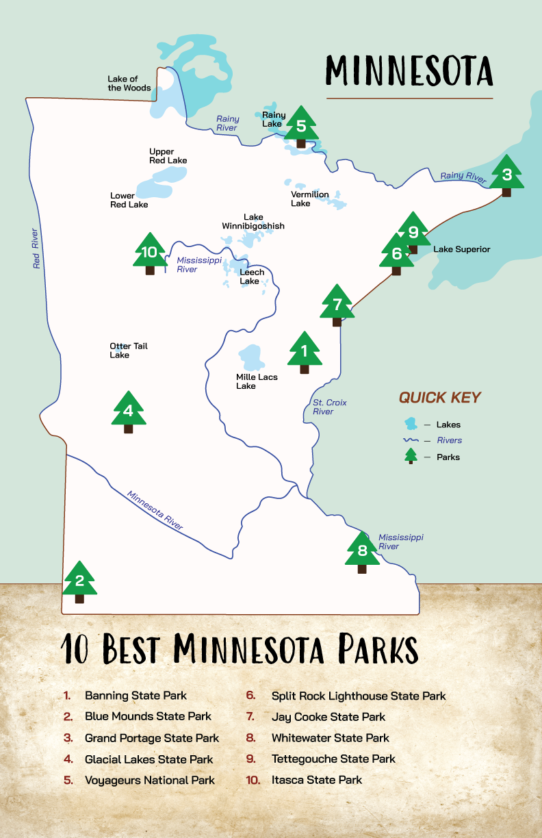
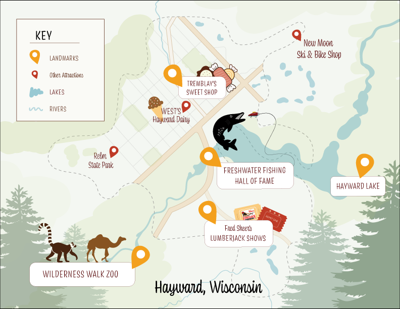
The goal of these assignments was to illustrate different maps for printed marketing material, as well as online use if desired.
Illustrated maps serve a purpose far beyond navigation and I wanted to bring that to life with these. I needed to highlight specific attractions and landmarks in a visually engaging way to capture tourists’ attention. I also wanted to tell a story and incorporate a little bit of history to encourage visitors to explore all the things these states have to offer. After many revisions of the illustrations and balancing all of the elements, I completed it by adding a key for reference and placing some additonal information for the viewers.
Adobe Illustrator